
Introduction: This article will depict 6 Stone Harbor post cards showing the “Grassy Sound” Bridge that connects North Wildwood and Stone Harbor. In addition, a brief historical sketch about the history of the bridge will be provided.
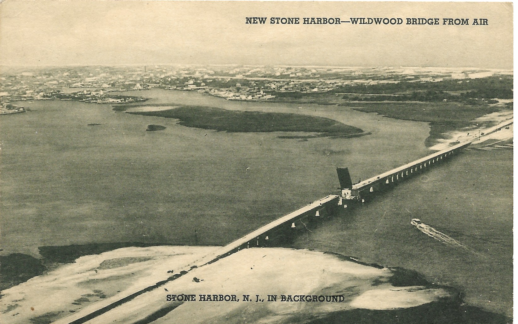
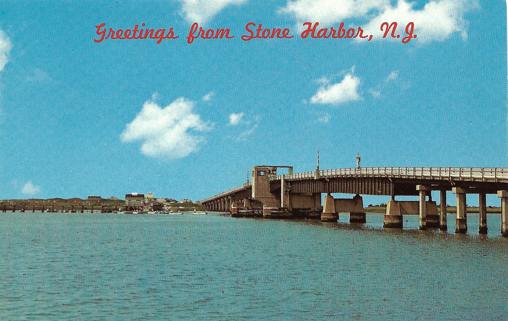
For many years the only way that one could travel directly from the Wildwoods to Stone Harbor was to take a shuttle boat or a regularly scheduled ferry service that operated out of Anglesea. The post card image just presented above shows the newly constructed bridge that connected the southern end of Stone Harbor, and for that matter the entire Seven Mile Island, over undeveloped marshlands and tidal islands with Wildwood. This Ocean Drive Bridge was officially opened for traffic on June 13, 1940 and this particular post card was mailed from Stone Harbor and the postmark is dated AUG 23, 1942.
Historically, our story begins during our country’s economic depression with the creation of the Cape May Bridge Commission in 1934. The purpose of the Commission was to apply for funds from the Federal Government to construct several much needed toll bridges along the coastal highway known as the Ocean Drive and thereby providing a new route to link the barrier islands along the coast including Atlantic City with Cape May, New Jersey. Under the New Deal Federal Emergency Administration of Public Works, the Commission received sufficient funds as well as approval for a loan to build a series of bridges: 5 with movable spans and 2 with fixed spans. This project would result in being the largest New Deal public works project in Cape May County and actually employed and provided income for approximately 500 local men during this important period of recovery after a decade long economic depression.
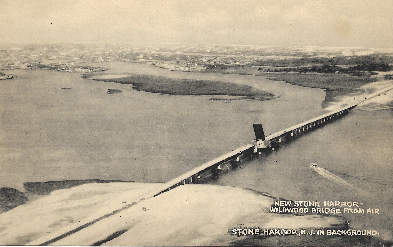
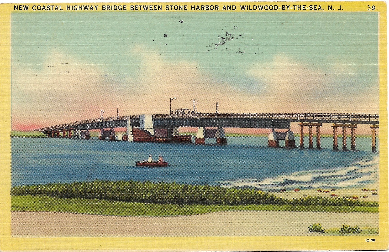
Construction began in 1939 and the bridges were completed in 1940. The type of bridge built between North Wildwood and Stone Harbor over the “Grassy Sound”, Middle Township, was described as a bascule span. For the sake of clarification, a bascule bridge is a structure that features a drawbridge in which one end is counterbalanced by the other on the principle of the seesaw or by weights. You will notice that the bridge shown in each of these first 2 images has its drawbridge in a fully raised position to allow the motor boat traveling north to pass safely through the opening. You might also see vehicles on the bridge heading south are waiting for the boat to pass and for the bridge to be lowered before proceeding. The bridge was manned by a person who operated the bridge raising and lowering mechanism 24 hours a day. The operator was situated in a little house for protection from the elements. In addition, there were safety sidewalks with metal railings for pedestrians crossing the bridge either on foot or by bicycle. There were also look-out areas on each side of the bridge with benches for sitting for those who wanted to stop and enjoy the view or just rest while walking across the bridge. Finally there was a toll booth at the center of the bridge adjacent to the movable span or leaf as it is called. Tolls were collected and set at $0.25 for most vehicles including passenger cars, pickup trucks and vans. The revenue generated from the tolls went for ongoing maintenance of the bridge. Apparently there have been 3 toll rate hikes over the many years since inception in 1940.
In addition, the Cape May Bridge Commission received funds for a bascule type bridge to be built to replace and update the earlier Ocean Parkway Bridge over the Great Channel on the route from Cape May Court House to Stone Harbor as the town’s entry point at 96th Street.
The Grassy Sound Bridge was an important part of the Intercoastal Waterway system. The waterway actually continues into a channel, which becomes part of the Atlantic Ocean just a short distance away. There was also a marina located at the foot of the bridge and fishermen used this area for recreational fishing. Even so-called birders or bird watchers enjoyed watching many types of bird species along the marshlands from the bridge since the Bird Sanctuary was very close and a great variety of migrating birds could be observed in that vicinity.

For those of you who are detail conscious like I am, I would ask you to go back and closely re-examine the first, second and fifth post card images shown in conjunction with this article. You may or you may not be able to see what I will tell you about regarding those 3 images. In any event, when I magnified those 3 images, I was able to vaguely detect the conspicuous water tower in the background scenery. What’s interesting from my point of view is that the water tower in the first two pictures was the old or original tower prior to replacement in the early 1940s. The silhouette of the water tower in the fifth post card while barely visible actually shows the later or newer tower built in the early 1940s to replace the tower shown in the first two images. Such observations and such details can actually enable one to ascertain the approximate time period in case the post cards do not bear any dated postal markings or dated hand-written notations. Just for your information, the water tower that most of us know that is in operation and serves Stone Harbor today was built in 1978.
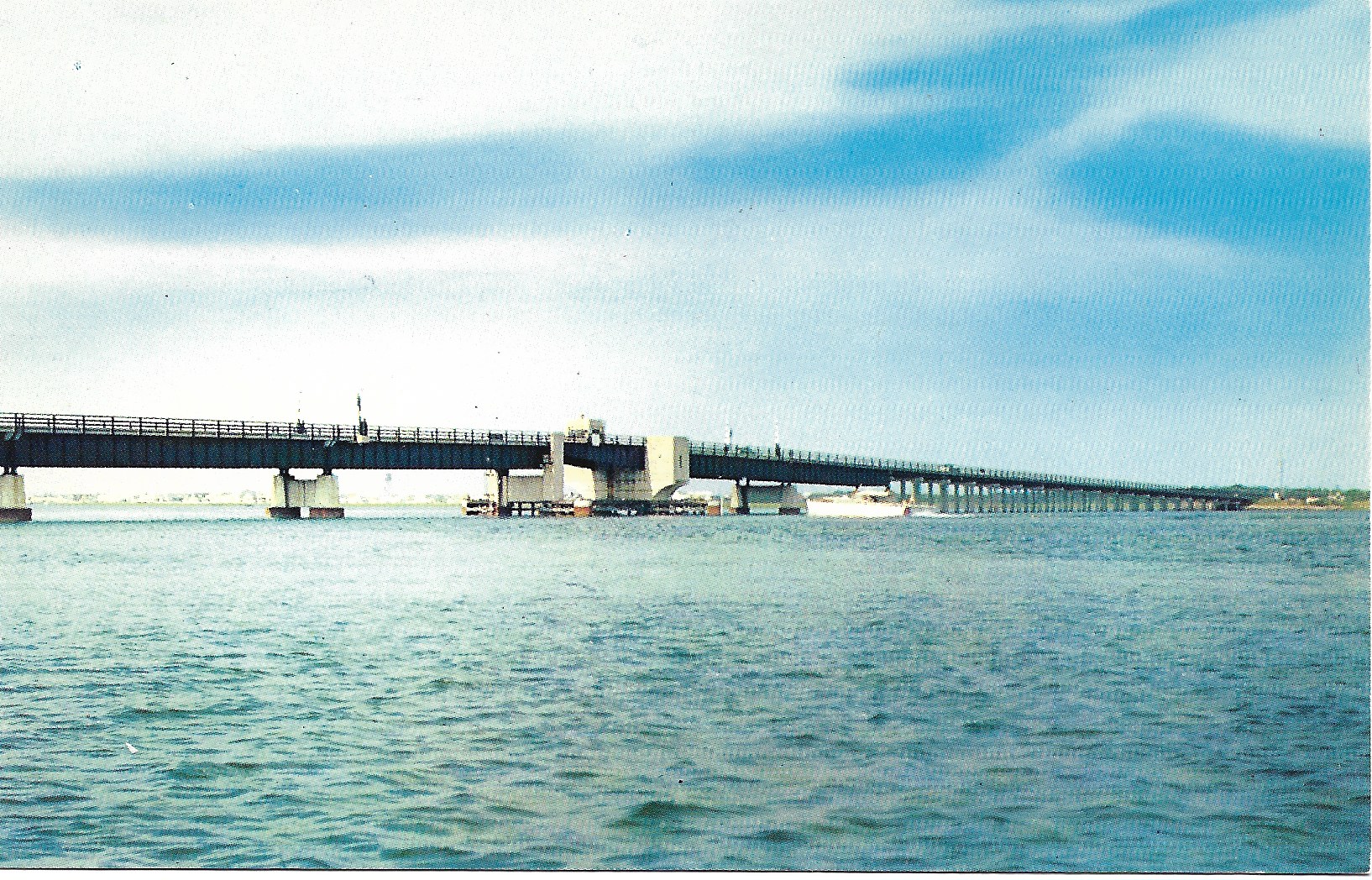
Lastly and just for your knowledge, the second post card in this sequence of 4 cards is undated while the third post card was postmarked in 1947 and the fourth card in this group was mailed in 1952. The last 2 chrome or more modern post cards are undated but are from the 1960s and 1970s, respectively.